
Features MeSIP
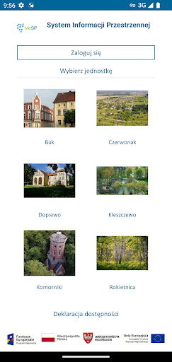
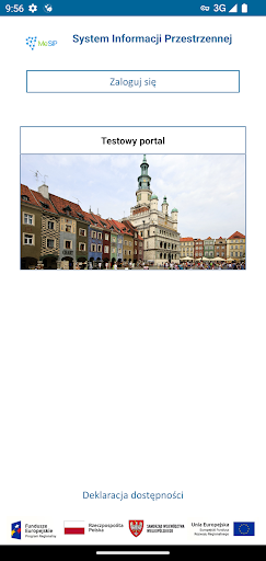
The application is implemented as part of the project "Construction of the Metropolitan Spatial Information System (MeSIP) for the Poznań Metropolis".The application presents spatial data of the Town and Commune of Śrem, the Town and Commune of Mosina, the Town of Luboń, the Town and Commune of Kostrzyn, the Town and Commune of Swarzędz, the Commune of Komorniki, the Town and Commune of Buk, the Town and Commune of Stęszew, the Town and Commune of Szamotuły, the Commune of Rokietnica, the Town and Pobiedziska Commune, Skoki Town and Commune, Murowana Goślina Town and Commune, Czerwonak Commune, Dopiewo Commune, Kleszczewo Commune, Kórnik Town and Commune, Oborniki Town and Commune, Puszczykowo Town, Suchy Las Commune, Tarnowo Podgórne Commune, City of Poznań and Poznań County.The application has basic functionalities that allow you to view shared spatial data:● Basic navigation tools in the map window;● Using the GPS signal to determine the users current location;● Adding external WMS services;● Search for addresses and parcels;● Measurements of length and area on the map;● Sending a link to the current map area;● Identification of objects on the map.● Change of background maps;● Changing the language;● Route mapping,● Augmented reality mode with the ability to identify objects.Recommendations and tips:● You will need an internet connection to download the map.● Enable location services in the phone settings for the application to work properly.
Social Features
Connect and share with friends and the community.
Fitness Tracking
Track your workouts and monitor your health metrics.
Travel Features
Plan and manage your travels with ease.
See the MeSIP in Action
Get the App Today
Available for Android 8.0 and above